- Altitude = 11500ft
- Trek length = 40km
- Best Time = March to June
- Duration = 6N/7D
- Inclusion = 🚘🍴🛌
- DIFFICULTY = Moderate
kalpeshwar Rudranath Trek
The Kalpeshwar and Rudranath trek is a popular pilgrimage and adventure trek in the Indian state of Uttarakhand. Both places are part of the Panch Kedar, a group of five sacred shrines dedicated to Lord Shiva.
Kalpeshwar: It is the first stop on the Panch Kedar pilgrimage. The main attraction is the ancient Kalpeshwar temple, located at an altitude of approximately 2,200 meters (7,218 feet). The trek to Kalpeshwar involves a moderate hike through lush green forests and beautiful landscapes.
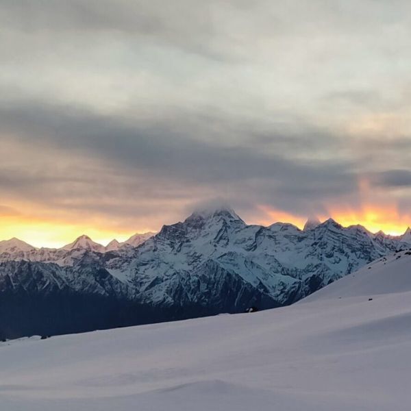
Rudranath: After visiting Kalpeshwar, the next destination is Rudranath, the third Kedar. The Rudranath temple is situated at an altitude of around 3,600 meters (11,811 feet). The trek to Rudranath is more challenging than Kalpeshwar, offering breathtaking views of the Himalayan peaks and surrounding valleys.
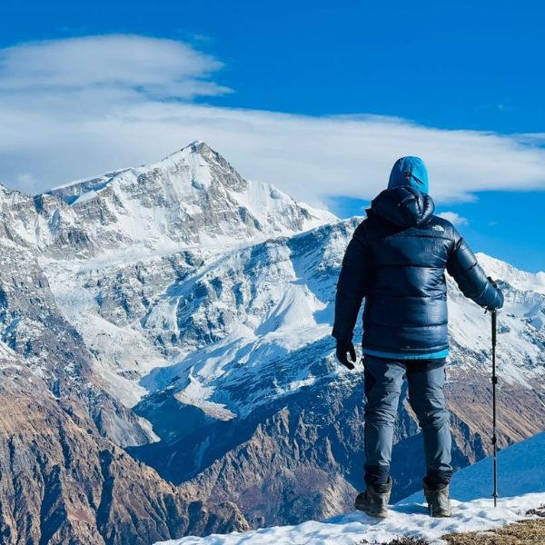
The entire journey to Kalpeshwar and Rudranath is spiritually significant and provides a unique opportunity to experience the natural beauty and cultural heritage of the region. It is advisable to undertake this trek with proper planning, a local guide, and necessary permits, especially if you are not familiar with the terrain and weather conditions
Detailed Itinerary
Day 1Drive from Rishikesh to Helang; 8-9 hours, 241 kmHelang to Devgram; 1 hour drive + 30 minutes trekDay 2Acclimatisation day; Trek to Kalpeshwar; 2-3 hoursDay 3Devgram (6,627 ft) to Bansi Narayan (11,482); 8-10 hours, 12 kmDay 4Bansi Narayan (11,482) to Dumak (7,874 ft); 5-6 hours, 10 kmDay 5Dumak (7,874 ft) to Panar (11,155 ft) via Toli (9,186 ft); 6-8 hours, 12kmDay 6Panar (11,155 ft) to Rudranath (11,811 ft) and back; 7-9 hours; 14 kmDay 7Panar (11,155 ft) to Sagar (6,561 ft); 4-5 hours, 12 km
Day 1: Reach Devgram
- Altitude: 6,627 ft
- Time taken: 10-12 hours drive; 30 minute trek
- Trail type: Initially a paved mud track which becomes cemented as you approach the village.
The journey to Devgram involves 3 steps. You first need reach Helang from Rishikesh, which is an 8-9 hours drive. From Helang, take a shared jeep to Devgram, in Urgam district. It should take you about an hour to reach Devgram. The last 2 km need to be trekked.
The initial trail is a stone paved mud track through green valleys. As you move closer to the village the trail becomes a cemented track. You can see terraced fields and settlements spread across the hills. You occasionally see villagers working in the fields. On the way, you will get a natural water tap shaped in the form of a cow’s mouth. Water flows through this all day.
Close to Helang, you’ll get to see the beautiful confluence of Alaknanda and Kalpganga rivers.
There are many guest houses in Devgram that offer accommodation and food at nominal rates.
Day 2: Acclimatisation Day; trek to Kalpeshwar and back
- Altitude: 7,217 ft
- Time taken: 2-3 hours
- Trail type: Easy. Initial ascent for 20-25 minutes followed by level walk for 10 minutes. Last 10-15 minutes is an ascent on steps.
- Water sources: Carry 1 litre of water. You’ll cross a river around midway, where you can refill
The trek to Kalpeshwar helps with acclimatisation. This is important because you will trek to Bansi Narayan on Day 3, which is at an altitude of 11,482 ft.
The trail from Kalpeshwar starts near Prathik lodge in Devgram. The trail initially climbs up a cemented track through settlements and fields. You will pass through green valleys in about 15 minutes. Proceed keeping to the left of the valley. In 5-10 minutes, you will see a waterfall ahead in the distance.
At this point, the trail becomes level. You walk through lush meadows. You can see the Kalpganga river to your right. This can also be used as a camping site if you wish to camp rather than stay in the village.
In another 5 minutes, you will reach a suspension bridge. You will find the steps going up to Kalpeshwar temple once you cross the bridge.
Return to Devgram on the same trail. You will find plenty of birds and flowers en route.
Day 3: Devgram to Bansi Narayan
- Altitude: 6,667 ft to 11,482 ft
- Time taken: 8-10 hours, 12 km
- Trail type: Moderate. Gradually ascending all the way to Bansi Narayan
- Water sources: Carry 2 bottles of water. First source is a stream at Bansa village, 1.5 hours into the trek. Second one is at Bansi Narayan temple, 4 hours away.
Start early today. Eat breakfast before leaving and also carry packed lunch since you will not find any place on the way to buy food.
From Prathik lodge, take the trail going towards the left. The trail passes through terraced fields where villagers grow rajma (kidney beans) and potatoes. This is all part of the Urgham valley. After 15-20 minutes of gradually ascending up this trail, you can spot settlements spread across the valley. Another 10-15 minutes of trekking bring you to a water – wheel. This channels water through a narrow stream call baanchaki or Gharat system to grind grains. Continue on this trail. In 40 – 45 minutes you reach Bansa village.
Bansa village has a beautiful Urvashi temple. This is right next to the water stream. You can take a break here if you wish. The stream water is clean and can be used to refill water bottles.
Near the temple, there is a sign which says “Bansi Narayan temple 10 kms from here” written in local language. Proceed from the temple and you will soon see a bridge. Take the ascending trail that you get after crossing the bridge. Stay to the left of the stream. The trail now gradually climbs up a ridge. In about 40 minutes, you will come across a small stone temple on the right side of the ridge. Continue on the trail, which now enters a thick forest. The mud trail moves up in a zig-zag way. As you move up the slope the woods get thicker. You will occasionally come across a few boulders. However, through all this, the trail is well defined. At places, it is bounded by a stone wall.
In about 45-50 minutes, you will come across a few boulders on the left side of the trail. This is a good spot to have lunch.
From here, the trail climbs up rather steeply now through dense woods. The mud trail is very pleasant through dense oak forest. The valley widens in about 45 minutes. You reach a clearing and get your first clear views of the Himalayan range around.
Around 30 minutes more on this trail brings you the top of the ridge. The trail now moves slightly towards your left. Within a few minutes you reach the Bansi Narayan temple. It takes around 7 – 8 hours to reach this point.
Bansi Narayan temple is surrounded by huge boulders. It is a single structure, built of stone. It is an ancient temple dedicated to the Hindu God, Vishnu.
Some of the overhanging boulders around the temple provide temporary shade. There is a small stream a few minutes from the temple. This is the only water source here. You can pitch tents here or proceed ahead to the natural cave that can accommodate around 30 – 40 people.
The cave is 25 – 30 minutes of gradual climb through lush green meadows and colorful wildflowers which are in full bloom in the months of August and September. The trail to the cave crosses the huge boulders beyond the temple. It moves first towards the right and then towards the left. The cave is to your right on this trail. You will see pink wildflowers in full bloom spread over the entire slope just before the cave. It is a little difficult to find the cave since it is middle between boulders spread across the meadows. You get mesmerizing views of snow-capped Himalayan peaks such as Nandadevi, Trishul, Dronagiri, Nandaghunti from the cave.
Day 4: Bansi Narayan to Dumak
- Altitude: 11,482 ft to 7,874 ft
- Time taken: 5-6 hours, 10 km
- Trail type: Easy. Gradually descending all the way to Dumak
- Water sources: Carry 2 bottles of water. First source is a stream at Bansi Narayan temple, 15 minutes into the trek. The second source is a stream around 40 minutes into the trek. The third water source is a stream outside Kalgoat, 1.5 hours into the trek.
Wake up early. Engulfed in clouds, Bansi Narayan Cave is an awesome campsite with splendid views of colorful wild flowers spread over lush green meadows with golden Himalayan peaks right in front.
Start on the trail back to Bansi Narayan temple. Once you cross the temple, the trail moves to the ridge to the right. You will enter the dense forest in 5-10 minutes. Continue on the mud trail keeping towards the right of the valley. This is a gentle downhill walk through overgrowth and thickets covered with colorful wildflowers. In another 10 minutes, you will cross a stream. The water is good to drink.
The trail, in this section, is shaded by gigantic chestnut trees. You come across a few fallen trees which require a little bit of scrambling to cross over. You will also have to cross a few boulders. Varieties of ferns and fungi appear on the way. At this point, the descent becomes steeper. You will enter a dense oak forest. After 45-50 minutes, the Alaknanda valley opens up ahead. This is Kalgoat village. You can take a break here.
Dumak is around 7 km from Kalgoat. The trail from Kalgoat village to Dumak village is well marked and takes 2 – 3 hours. Continue on the trail that passes through huge boulders and shrubs. 20 – 30 minutes of hike across the village brings you to an old Mahadev temple built of stone. This temple is at the other end of the village – the Dumak side. Just before the temple is a narrow bridge over a small stream – the water here is good to drink. After crossing the bridge you will find a bell and prayer flags tied to a pole.
The construction of the poles is such that it forms an entry gate. A new shade has been put up in front of the old stone temple. Continue on the trail that passes through woods and shrubs. If you’re lucky, you might spot a monal. It’s a level walk now. Dumak village becomes visible in the distance after about an hour. Terraced fields appear around you. Also visible are water channels to the fields. You will reach a blue signboard for a pre-primary school in about 40 minutes.
You can either stay at Bhandari guest house, which is around 5 minutes ahead on the trail or camp next to the stream, a little ahead. Bhandari guest house can provide basic food and stay arrangements at a nominal price.
Day 5: Dumak to Panar via Toli
- Altitude: 7,874 ft to 11,155 ft via 9,186 ft
- Time taken: 6-8 hours, 12 km
- Trail type: Initial level trail for 25 minutes followed by 45 minutes of steep descent. 3 hours of ascent to Panar from Toli.
- Water sources: Streams along the trail
Start early since it will be a long day. Take the cemented trail that leads out of Dumak village on the other side. It passes through terraced fields. In about 25 minutes, you will reach the end of the ridge. Here, take the trail that goes to the right. This is a narrow mud trail which descends steeply. Stay at right side of the valley. Rudra Ganga river becomes visible in 20-30 minutes.
You will reach the river in about 45 minutes. The view of the river as you cross it over the cemented bridge, is stunning. This is a good spot to take a break and refill your water bottles.
After crossing the river, the trail moves towards the right, ascending into the woods. After 20-30 minutes, the trail becomes level. It turns left, where you will cross a few streams. Continue on the trail that ascends from here. It keeps getting steeper. You will notice it climbing up a ridge in 25-30 minutes. In about 45 minutes, you will reach the end of the ridge, and enter the huge meadows of Toli.
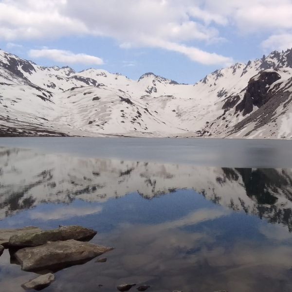
The trail up from the river till Toli is infested with leeches, especially in the months of August and September. Toli has huge green grasslands with a beautiful alpine lake, surrounded by thick forest. You can also see a few temporary settlements used by the shepherds. The meadows of Toli are filled with cattle grazing in the summer and monsoon. This is a good place to break for lunch.
From Toli, the path becomes a little tricky. There are very few landmarks. Continue on the trail that moves towards your right. The trail gently climbs up the ridge. You almost reach the end of the ridge in 30-40 minutes. You will see a small meadow over the ridge.
Here, the trail moves to your left. It traverses the meadow and gently climbs up a ridge. Keep climbing up to the left till the ascent that becomes steeper. After 45-50 minutes, you notice the vegetation becoming thinner. Continue on this trail till you reach the top of the ridge. From here, the path moves around the mountain to your right to the sloping meadows of Panar (11,155 ft). It takes 2-3 hours from Toli and 6-8 hours from Dumak to reach Panar.
Panar has a tourist hut and a shepherd settlement nearby. Both provide food. Pilgrims also stay in the cave which is a few metres above the Panar meadows on the route to Rudranath. From Panar you can see beautiful snow capped mountains of Nanda Devi, Trishul and Nanda ghunti and the Bandarpoonch massif. In the month of August and September Panar turns into a carpet of pinkish red flowers. There is a thin water stream a few metres below the tourist hut. The water from the stream can be used for drinking and cooking.
Day 6: Panar – Rudranath – Panar
- Altitude: 11,155 to 11,811 ft to 11,155 ft
- Time taken: 6-8 hours, 12 km
- Trail type: Moderate. Gradually ascending trail to Rudranath.
- Water sources: None till you reach Rudranath. Carry 2 litres of water.
Start in the morning, after breakfast. Take the trail that moves towards the ridge to the left. You will see some huge boulders and snow-capped peaks to your left.
The trail gradually climbs up the ridge. You will notice some undergrowth on the way. After 25-30 minutes of ascent, you can see the Panar meadows below. In another 30-40 minutes, you reach a huge overhanging boulder on the left. From here, the scene is magnificent – the vast green meadows of Panar below and snow-capped peaks in front, engulfed in clouds.
Continue on the trail that climbs up the ridge. As you climb up you see huge boulders on the right and in the front.
Continue on the trail, till you see huge boulders on the left and a lush green valley on the right. It takes around 1.5 – 2 hours to reach here. You will shortly reach a stretch where there are huge boulders on either side of the trail. From here, the trail is well defined. This is a stone path, mostly a gentle trail with a few gradual ascents. This ridge between Panar and Rudranath has unmatched views of the Himalayas. You are surrounded on all sides by snow-capped peaks and lush green valleys.
A narrow ridge on the left connects Rudranath to Mandal forest and Anusuya temple. This is a beautiful trail that passes through the Mandal forest. You have the option of taking this trail on your way back from Rudranath.
Proceed ahead on the trail. You are now surrounded by colorful flowers and shrubs. Notice the temporary shepherd settlement made of stone to your left. Continue on the mud trail that gradually ascends, keeping the valley to your left. You will soon see prayer bells and flags in the distance. It takes 15-20 minutes to reach them.
This is the highest point on this trail. It takes 3-3.5 hours to reach here from Panar. The trail now descends into the valley. You see bright flowers and shrubs around. This valley is known for medicinal herbs. Continue on the trail as it climbs up a ridge. Spread over a couple of hundred meters on either side of the ridge are colorful wildflowers and a lush green meadow.
Rudranath shrine becomes visible at a distance after an hour of hike. The trail descends first and then ascends. In 25-30 minutes you will reach a brightly painted tourist hut. It has 2 rooms that are used by pilgrims and tourists who wish to stay overnight at Rudranath.
Continue past the tourist hut. In a few minutes you will come across a small stone idol and a temple dedicated to Devrishi Narad. Further up the trail notice settlements to the left. These belong to the temple priest and locals.The Rudranath shrine will be to your left and the lush green valley, to your right. It takes around 4.5 hours to reach here from Panar. Rudranath shrine is surrounded by huge rock walls and boulders. It is bounded on each side by a pond – Surya Kund, Chandra Kund, Tara Kund and Manas Kund. The Bandarpoonch range is very prominent from here. There are places around the temple that serve lunch. Return to Panar after lunch.
Day 7: Panar – Sagar
- Altitude: 11,155 to 6,561 ft
- Time taken: 4-5 hours, 12 km
- Trail type: Easy. Gradual descent all the way.
- Water sources: Carry 2 bottles of water from Panar
Start after breakfast. Take the stony mud trail descending to the left from Panar. This brings you down the ridge in a zig-zag manner. The grasslands of Lunti Bugyal become visible in 15-20 minutes. You will reach Lunti Bugyal in another 10 minutes.
From Lunti Bugyal, continue on the trail that moves towards your left. The trail enters a dense forest in 15-20 minutes. This is now a mud trail but it is well defined. You will reach a water stream in 45 minutes. Cross it over the cement bridge. The trail descends into woods after the bridge. A beautiful meadow becomes visible in the distance in 25-30 minutes. It will take you another 15 minutes to reach this meadow. It is surrounded by forests on all sides.
Continue on the trail that enters another forest from the meadow. In 30-45 minutes, the forest clears and you will see terraced fields to your left. Sagar also becomes visible. Continue moving down the well-defined trail that moved through the fields. There is a stream just before Sagar. From here, the trail becomes narrow and passes through rocky steps all the way to Sagar.
Accommodation: 2 Nights in a Hotel / Homestay in Joshimath on a triple-sharing basis. 3 Nights Tented Accommodation on a triple sharing basis.
Transportation: Surface transfer from Rishikesh – Joshimath – Rishikesh by Sumo / Bolero / Tempo Traveler (Depending on the number of travelers).
Meals: All vegetarian meals from day 1st Dinner to day 6th Breakfast.
Snacks: Morning / Evening Tea / Coffee with light snacks and soup while on the trek.
Camping logistics: Tent, Sleeping bags, Mattresses, Dining tent.
Trek Leader: Qualified and Experienced Trek leader and support staff.
Permits: All necessary fees and permits.
Trekking Equipment: Gaiters, Micro Spikes, and Rope if required.
Safety Equipment: Basic First Aid kit with Oximeter and Oxygen Cylinder.
Guide ratio: 1:10
5% GST
Any expenses of personal nature.
Meals during transit.
Any insurance of any kind.
Any fees and permits (for non-Indians).
Unscheduled delay due to landslide.
Cost Escalation due to “ Force Majeure and Evacuation charges”.
Anything not mentioned explicitly in the above program.
Note: You can apply for travel insurance before the trek.
For a Himalayan trek, consider packing the following essentials:
Warm clothing (thermal layers, fleece, down jacket) waterproof and windproof outer layers (jacket and pants) sturdy hiking boots with good ankle support Backpack with a rain cover
sleeping bag suitable for cold temperatures Sleeping pad/mattress for insulation Hat, gloves, and scarf sunglasses and sunscreen for high-altitude protection
water bottles and water purification method (filters or tablets) high-energy snacks and food for the trek first aid kit with essential medications and blister care items
trekking poles for better stability and support Headlamp or flashlight with extra batteries personal toiletries and wet wipes Multi-tool or pocket knife
camera and spare memory cards for capturing memories personal identification and necessary permits for the trek
remember to travel light but adequately prepared for the challenging conditions of a himalayan trek. Always check the specific requirements for the trek you are planning to undertake
Our Cancellation Policy-
Cancelling prior 21 days from trek start date – 10% deduction charges, 90% is refunded.
Cancelling prior 15-20 days from trek start date – 30% deduction towards GST, Transaction, accommodation at Base, ration, etc. 70% is refunded.
Cancelling prior 7-14 days from trek dates – 50% deduction towards GST, Transaction, accommodation at Base, ration, Trekleaders, permits, equipment etc. 50% is refunded.
Cancelling prior 1-6 days from trek dates – 100% deduction As all arrangements are made by transhimalaya and we are set to take you on a trek.
Trek Voucher terms and Condition –
– The Voucher will be valid for 6 Months from date of issuance
– The Voucher can be used in any trek with Trans Himalaya.
Trans Himalaya Send Us Enquiry
Related Posts
GUPT KHAL EXPEDITION – A COMPLETE OVERVIEW
Team Trans Himalaya www.transhimalaya.in Expedition Summary The Gupt Khal Expedition (5,804m) is a challenging high-altitude trek in the Nanda Devi Biosphere Reserve, offering breathtaking views of Changabang, Kalanka,
Exploring the Enchanting Beauty of Uttarakhand
Introduction Uttarakhand, nestled in the lap of the Himalayas, is a captivating destination that beckons travelers with its pristine landscapes and cultural richness. Land of Spiritual RetreatsKnown
Himalayan Adventure, Himalayan trek
A Himalayan Adventure: Trekking Through Majestic Peaks Prelude to the Journey Embarking on a Himalayan trek is not merely a physical endeavor; it’s a soul-stirring odyssey into the